At first, it’s just woods. Trails. River bends. Then you notice the shapes—lines that don’t belong to nature. Deep Bottom is one of those places where what you’re seeing today—the quiet woods—is basically a faded battlefield map. The earthworks there aren’t random—they’re directly tied to a very specific moment in 1864.
This was one of the most active Civil War crossing points on the James River. In late June 1864, Union forces crossed the James River at Deep Bottom and established a bridgehead (a foothold north of the river). As soon as they crossed, they started digging defensive earthworks—trenches, rifle pits, and fortifications—to hold that position. These were not permanent forts—they were rapid, field-built entrenchments, thrown up by soldiers in hours or days.
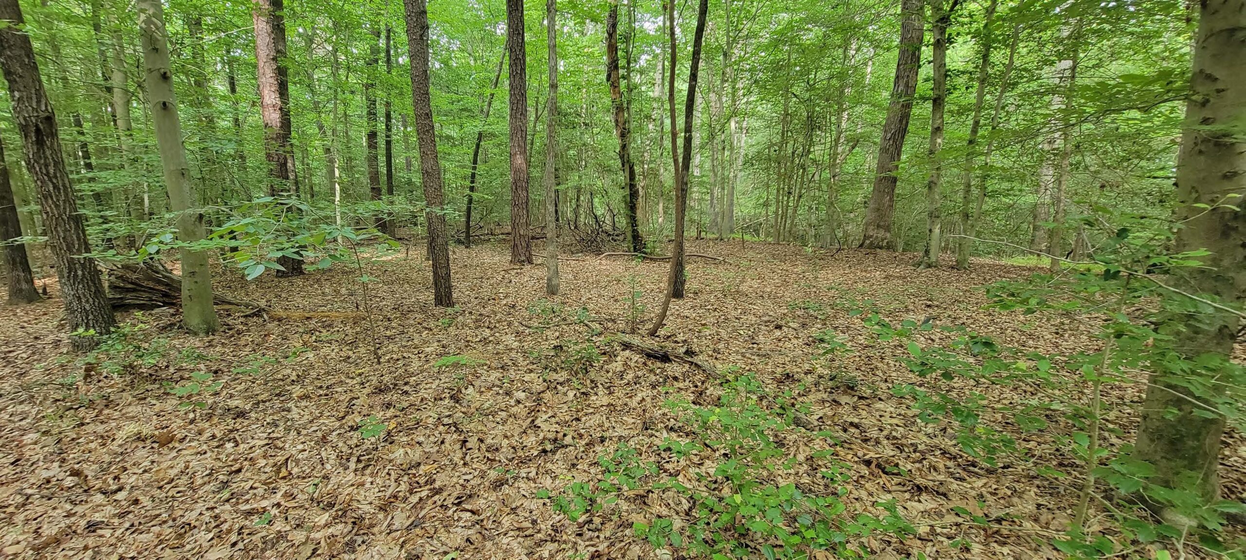
Union forces used Deep Bottom to threaten Richmond from the east, building extensive earthworks that still sit just beneath the surface. Unlike battlefields turned into parks, this one never fully announces itself. History here isn’t marked. It’s felt.
What remains are earthen fortifications and trenches; subtle elevation changes that map the past; a landscape that only reveals itself if you know how to look
Why it feels different from other Civil War sites
Most battlefields are: cleared, marked and interpreted. Deep Bottom is: Naturally reforested, minimally marked, and spatially intact but visually subtle. All of this means you’re not looking at a preserved battlefield. You’re walking through one that has reverted back to landscape.
What makes Deep Bottom special isn’t just that battles happened there. It’s that the topography still holds memory. The earthworks weren’t turned into monuments, so the meaning is embedded in the ground, not the signage. It might be the closest thing Richmond has to a “hidden battlefield.”
While walking, constantly ask: Does this look too linear to be natural? Is there a ditch/ridge pairing? Does the land feel like it was organized for a purpose? If yes—you’re looking at it.